|
Inyo County California Last Updated: 04/17/2023 |
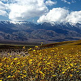
| Inyo County is a county located in the eastern part of California, United States. It is known for its spectacular natural beauty and is home to several national parks and wilderness areas, including Death Valley National Park, Mount Whitney, and the Ancient Bristlecone Pine Forest. In the 2020 census, the population was 19,016. The county seat is Independence. | |
| In addition to its natural attractions, Inyo County also has a rich cultural history, with several historic sites and museums dedicated to preserving the area's past. The Manzanar National Historic Site, located in the Owens Valley, tells the story of Japanese American internment during World War II, while the Laws Railroad Museum in Bishop offers a glimpse into the region's mining and railroad history. Outdoor enthusiasts will find plenty to do in Inyo County, with opportunities for hiking, camping, fishing, and rock climbing throughout the area. Mount Whitney, located in the eastern Sierra Nevada range, is the highest peak in the contiguous United States and is a popular destination for hikers and mountaineers. The Ancient Bristlecone Pine Forest, located in the White Mountains, is home to some of the oldest trees in the world, with some specimens estimated to be over 4,000 years old. Visitors can take a scenic drive through the forest and explore several hiking trails that offer stunning views of the surrounding mountains and valleys. Inyo County also has several hot springs, including the popular Hot Creek Geological Site, which features hot springs that flow into a cold stream and create a series of natural pools. The area is also known for its stargazing opportunities, with several designated dark sky areas and observatories located throughout the county. Overall, Inyo County is a beautiful and diverse destination that offers something for everyone, from outdoor adventurers to history buffs and nature lovers. | |
Wikipedia
Inyo County » Iny
Place » City

|
Valley Wells Place » Town Valley Wells is a census-designated place in Inyo County, California. The 2010 census reported that population was zero. Valley Wells is situated in the Mojave Desert, a vast arid region in southeastern California. It lies near the Nevada border and is accessible via Interstate 15, which is a major route connecting Southern California to Las Vegas. 20 views 💖 1California |

|
Father Crowley Overlook Place » Outdoors Father Crowley Vista Point was a favorite stopping place for travelers. Located near the western park boundary, this vista point offers a stunning view into Rainbow Canyon, a colorfully striped canyon created by ancient volcanic activity. A short ¼ mile (400 m) walk or drive on an unpaved road leads from the vista parking area to Padre Point, overlooking Panamint Valley. 16 views 💖 1Parking lot, CA-190, Inyo, CA |
|
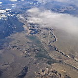
Round Valley Place » Town Round Valley is a census-designated place in Inyo County, California, located 7.5 miles northeast of Mount Tom, at an elevation of 4,692 feet (1,430 m). The population was 435 at the 2010 census, up from 278 at the 2000 census. 18 views 💖 1California |
|
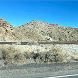
Homewood Canyon Place » Town Homewood Canyon is a remote and sparsely populated area located in Inyo County, California, in the eastern part of the state. It is situated in the eastern Sierra Nevada region, not too far from the Nevada border. Homewood Canyon sits at an elevation of 3,074 feet (937 m). The 2010 United States census reported Homewood Canyon's population was 44. 40 views 💖 1California |
|
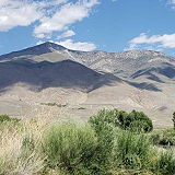
Wilkerson Place » Town Wilkerson is a small community located in Inyo County, California. It is situated in the Owens Valley, which lies between the Sierra Nevada and the White Mountains. The community is located at an elevation of approximately 4,400 feet (1,341 meters), providing a relatively mild climate compared to the lower desert areas. The population was 563 at the 2010 census, up from 562 at the 2000 census. 25 views 💖 1California |
|
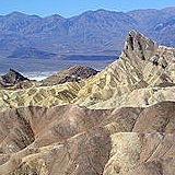
Zabriskie Point Place » Outdoors Zabriskie Point is a famous viewpoint in Death Valley National Park, California. Known for its dramatic and colorful landscape, it offers a stunning vista of the eroded and barren badlands of the Furnace Creek Formation. The landscape at Zabriskie Point has been shaped over millions of years through the erosion of sediments that were once part of an ancient lake bed. 25 views 💖 1California |
|
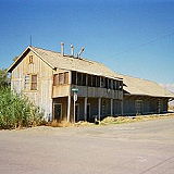
Keeler Place » Town Keeler is another small unincorporated community located in Inyo County, California. It lies on the eastern shore of the now largely dry Owens Lake. Approximately 3,600 feet (1,100 meters) above sea level. It is situated about 10 miles southeast of Lone Pine and 12 miles east of Olancha. The population was 71 people at the 2020 census, up from 66 at the 2010 census. 25 views 💖 1California |

|
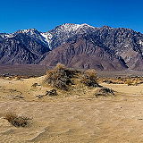
Mesa Place » Town Mesa is a census-designated place in Inyo County, California, United States. The population was 251 at the 2010 census, up from 214 at the 2000 census. Inyo County is known for its beautiful and varied landscapes, including parts of the Eastern Sierra Nevada, Death Valley National Park, and other natural attractions. 37 views 💖 1California |
|
Olancha Peak Place » Outdoors Olancha Peak is a prominent mountain located in the Sierra Nevada mountain range of California, in Inyo County, California. It is approximately 50 miles south of Lone Pine and Independence and is easily visible from the Owens Valley. Olancha Peak has an elevation of 12,123 feet (3,695 meters) above sea level, making it one of the notable peaks in the Southern Sierra Nevada. 36 views 💖 1California |
|
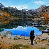
Lake Sabrina Place » Outdoors Lake Sabrina is a scenic alpine lake located in the Eastern Sierra region of Inyo National Forest, in the eastern part of Inyo County, in the eastern Sierra Nevada mountains of California. It is near the town of Bishop and is part of the Inyo National Forest. It is known for its stunning mountain scenery, clear waters, and recreational opportunities. 30 views 💖 1Inyo County, California |