|
Skyline Drive Trail Skyline Dr, Corona, CA 92882 ☎ (951) 736-2241 Last Updated: 04/21/2023 |
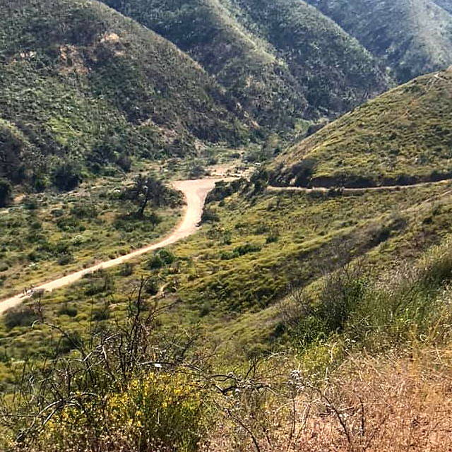
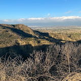
| Skyline Drive Trail is a hiking trail located in Corona, a city in Riverside County, California, United States. The trail is situated in the Santa Ana Mountains and offers scenic views of the surrounding hills and valleys. The trail is approximately 5 miles long and is considered moderately difficult, with steep inclines and rugged terrain. | |
| The trailhead is located at Skyline Drive, near Foothill Parkway. The trail offers a variety of vegetation, including chaparral, sagebrush, and oak trees. Hikers can enjoy panoramic views of the city of Corona and the surrounding valleys. The trail is also home to various wildlife, including birds, reptiles, and small mammals. Skyline Drive Trail is a popular spot for hiking, nature watching, and photography. The trail is open year-round, but it is recommended to avoid the trail during the summer months due to high temperatures. | |
Riverside County » Corona
Place » Outdoors

|
Mountain Gate Park Place » Outdoors Mountain Gate Park is a 21-acre park located in Corona California featuring ADA Accessible, Barbecue, Basketball Court, Bicycle Rack, Covered Shelter, Drinking Fountain, Educational / Historical Display, Picnic Area, Playground, Restrooms, Softball Field and Tennis Court. 72 views 💖 13100 S Main St, Corona, CA 92882 |
|
Lake Mathews Estelle Mountain Reserve Place » Outdoors This largest undeveloped expanse of habitat in western Riverside Co. features a large reservoir (Lake Mathews) surrounded by annual grassland and arid, Riversidean Coastal Sage Scrub that extends over hilly terrain about 10 miles south to Interstate 15. Much of the land has been designated the Estelle Mountain Lake Mathews Reserve. 83 views 💖 1Corona, CA 92883 |

|
Montecito Ranch Park Place » Outdoors Montecito Ranch Park is a public park located in Corona, a city in Riverside County, California, United States. The park features 22 acres of rolling hills and offers various recreational amenities, including hiking trails, picnic areas, a playground, and sports fields. 95 views 💖 18607 Calle Canon Rd, Corona, CA 92883 |
|
Corona Place » City Corona is a city located in Riverside County, California, United States. It is located approximately 45 miles southeast of Los Angeles and 95 miles north of San Diego. As of the 2020 census, the population of Corona was 170,616, making it one of the largest cities in the Inland Empire region of Southern California. 173 views 💖 1California |
|
Tin Mine Canyon Place » Outdoors Tin Mine Canyon is a hiking trail located in Corona, a city in Riverside County, California, United States. The trail is situated in the foothills of the Santa Ana Mountains and offers scenic views of the surrounding hills and canyons. The trail is approximately 2.5 miles long and is considered moderately difficult, with steep inclines and uneven terrain. 137 views 💖 1Corona, California |
Write a Review :
Skyline Drive Trail
|
|
