|
Summit of Colby Trail Upper Colby Trail, Glendora, CA 91741 ☎ 626.914.8200 Last Updated: 04/27/2023 |
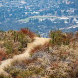
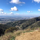
| The Colby Trail is a popular hiking trail located in Glendora, California. The summit of the Colby Trail is located at an elevation of approximately 2,500 feet and offers panoramic views of the San Gabriel Mountains, the San Gabriel Valley, and the Los Angeles Basin. | |
| The Colby Trail is approximately 5 miles long and is considered a moderate hike with some steep sections. The trailhead is located at Glendora Wilderness Park, which features picnic areas, restrooms, and parking. From there, hikers can follow the trail up the mountain, passing through a variety of terrain, including chaparral, oak woodland, and rocky outcroppings. At the summit of the Colby Trail, hikers can take in views of the surrounding landscape, which includes the peaks of Mount Baldy, Mount San Antonio, and Mount Wilson. On clear days, it is possible to see as far as the Pacific Ocean and Catalina Island. Hikers are advised to bring plenty of water, wear sturdy hiking shoes, and be prepared for changing weather conditions. The Colby Trail is open year-round and is a popular destination for outdoor enthusiasts in the Glendora area. | |
Website Facebook
Los Angeles County » Glendora
Place » Outdoors
|
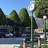
Glendora Place » City Glendora is a city in the San Gabriel Valley in Los Angeles County, California, 26 miles (42 km) east of Los Angeles. As of the 2020 census, the population of Glendora was 52,558. The city is known for its beautiful tree-lined streets and is often referred to as the "Pride of the Foothills." 67 views 💖 1California |
|
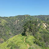
Big Dalton Wilderness Area Place » Outdoors Big Dalton Wilderness Area will allow your guests to enjoy your special moment in Glendora's vast canyons. This park is perfect for wedding ceremonies, baby showers, family reunions, birthday parties, overnight group tent camping and more! 89 views 💖 12041 Big Dalton Canyon Rd, Glendora, CA 91741 |
|
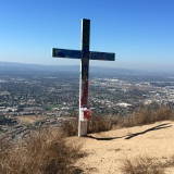
The Cross Place » Outdoors The Cross in Glendora, California is a large, illuminated cross that is located on the top of the hill at the intersection of Grand Avenue and Gladstone Street. The cross stands at approximately 110 feet tall and is visible from many parts of the San Gabriel Valley. 93 views 💖 1Glendora Ridge Mt Way Glendora, CA 91741 |
|
Top of Punk Out Trail Place » Outdoors The Punk Out Trail is a popular hiking trail located in Glendora, California. The trail is approximately 2.7 miles long and is considered a moderate hike with some steep sections. The top of the Punk Out Trail offers panoramic views of the surrounding mountains and valleys, including the San Gabriel Mountains, the San Gabriel Valley, and the Los Angeles Basin. 85 views 💖 1Lower Monroe Rd, Glendora, CA 91741 |
Write a Review :
Summit of Colby Trail
|
|
