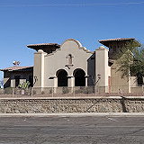
La Fayuca is a popular Mexican restaurant located in Heber, California. Known for its authentic Mexican cuisine, La Fayuca offers a variety of traditional dishes such as tacos, burritos, carne asada, and other delicious Mexican food. The restaurant is highly rated for its cozy atmosphere, friendly service, and generous portions.
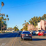
Heber is a Census Designated Residential Area in Imperial County, California. It is located at an elevation of -9.8 ft (-3 m). Heber is 4.5 miles (7 km) north-northwest of Calexico. The population was 6,896 in the 2020 census, up from 4,275 in 2010.
Calexico is a city in southern Imperial County, California. According to the 2020 census, Calexico had a population of 38,633. Located on the Mexican border, the city has strong economic ties to the much larger city of Mexicali, the capital of the Mexican state of Baja California.
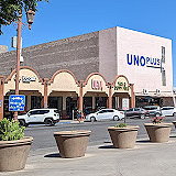
Spanning nearly 280,000 square feet and situated right next to the Calexico West Port, Gran Plaza Outlets houses nearly 40 stores from renowned designers and brands. These range from Michael Kors, adidas, Banana Republic, and Levi’s Outlet Store to H&M, Coach, and Gap Factory Store.
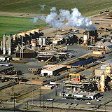
Calipatria is a city in Imperial County, California. It is located 37 km north of El Centro and is part of the El Centro Metropolitan Area. The population was 6,515 according to the 2020 census, down from 7,710 in 2010 but up from 7,289 in 2000, including 4,000 inmates at the Calipatria State Prison.
Holtville is a city in Imperial County, California. The city is located at an elevation of -9.8 ft (-3 m). Holtville is 10.5 miles (17 km) east of El Centro. Its 2020 population was 5,605, down from 5,939 in 2010. The city lies on the northeast bank of the Alamo River, one of two rivers that flow north from Mexico into Imperial County.
Palo Verde is a census-designated location in Imperial County, California. It sits at an elevation of 71 meters (233 ft). Its name derives from the native desert tree, Palo Verde, which in turn comes from the Spanish words for stick (palo) and green (verde), and shares its name with the Palo Verde Valley, the valley in which it is located. According to the 2020 census, Palo Verde had a population of 152.
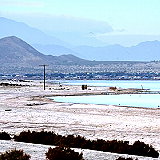
Salton Sea Beach is a census-designated location in Imperial County, California. It is situated at an elevation of -217 ft (-66 m). The population was 508 in the 2020 census, up from 422 in 2010 and 392 in 2000. Salton Sea has an extremely high salt content and is surrounded by salt flats that can be easily broken by hand.
Seeley is a census-designated location in Imperial County, California. It is situated at an elevation of -36 ft (-11 m). Seeley is located 7.5 miles (12 km) west of El Centro. The population was 1,729 in the 2020 census, down from 1,739 in the 2010 census. It is part of the El Centro metropolitan area.
Westmorland is a city in Imperial County, California. It is located 8.5 miles (14 km) southwest of Calipatria. The city sits at an elevation of -164 ft (-50 m). The population was 2,014 according to the 2020 census, down from 2,225 in 2010, but up from 2,131 in 2000. Westmorland is part of the El Centro metropolitan area.
Desert Shores is a census-designated location in Imperial County, California. It is situated at an elevation of -200 ft (-60 m). The town lies on the western shore of the Salton Sea in the Imperial Valley, within the Colorado Desert Ecosystem. According to the 2020 census, Desert Shores had a population of 1,128.
Salton City is a census-designated location within Imperial County, California. It is situated at an elevation of -125 ft (-38 m). It is the largest residential area in Imperial County on the Salton Sea coast. According to the 2020 census, the population was 5,155, an increase from 3,763 in 2010 and 978 in 2000.
Winterhaven is a census-designated location within Imperial County, California. The population was 390 according to the 2020 census. It is part of the El Centro, CA metropolitan area. Located north of Interstate 8 and bordering Yuma, Arizona, the town is part of the Fort Yuma Indian Reservation. The Colorado River marks the town's southern boundary.
Niland is a census-designated place in Imperial County, California. The town is located 8 miles (13 km) north of Calipatria, 2 miles (3.2 km) southeast of the Salton Sea. The population was 1,006 at the 2010 census, down from 1,143 in 2000. The 2020 census reported Niland's population at 756.
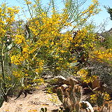
The Algodones Dunes is a large sand dune field located in southeastern California, in the Imperial County. The dunes span an area of approximately 45 miles long and 6 miles wide, and are the largest dune field in the state of California. They are also one of the largest dune fields in North America.
Imperial County is a county located on the southeast border of the U.S. state of California. As of the 2020 census, the population was 179,702, making it the least populous county in Southern California. This area is known as the Imperial Valley. The county seat and largest city is El Centro.
Bombay Beach is a census-designated place in Imperial County, California. It is located on the Salton Sea, 4 miles (6.4 km) west-southwest of Frink and is the lowest community in the United States, located 223 feet (68 m) below sea level. The population was 231 at the 2020 census, down from 295 in 2010, down from 366 in 2000.
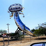
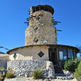
The Desert View Tower is a historic roadside attraction located in In-Ko-Pah Gorge off Interstate 8 in Jacumba, California. It's not far from Ocotillo, which you mentioned in your previous question. The tower was built in the 1920s and has served as a landmark and rest stop for travelers in the desert.
The Boulder Park Mystery Caves and Desert View Tower make for a quirky and fun half-day trip for families who likes to explore and climb. This also makes a great roadside stop to stretch your legs if you are driving to or from Arizona, something we find ourselves doing fairly regularly. The carvings and tower are registered as an official California Historical Landmark.