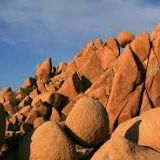
Joshua Tree National Park is an American national park in southeastern California, east of Los Angeles, near San Bernardino and Palm Springs. Dark night skies, a rich cultural history, and surreal geologic features add to the attraction of this place.
The Santa Rosa and San Jacinto Mountains National Monument is a protected area located near Palm Desert, in Southern California, within Riverside County. It encompasses parts of the Santa Rosa and San Jacinto Mountains, covering a vast and diverse landscape. It is managed by the Bureau of Land Management and the United States Forest Service.
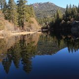
Lake Fulmor is a picturesque alpine lake located in the San Jacinto Mountains of Riverside County, California. Situated at an elevation of around 5,300 feet (1,615 meters), it offers stunning natural beauty and a tranquil atmosphere. The lake is surrounded by towering pine trees and lush forest, making it a popular destination for outdoor enthusiasts seeking hiking, fishing, picnicking, and camping opportunities.
Skyline Drive Trail is a hiking trail located in Corona, a city in Riverside County, California, United States. The trail is situated in the Santa Ana Mountains and offers scenic views of the surrounding hills and valleys. The trail is approximately 5 miles long and is considered moderately difficult, with steep inclines and rugged terrain.
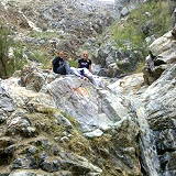
Tin Mine Canyon is a hiking trail located in Corona, a city in Riverside County, California, United States. The trail is situated in the foothills of the Santa Ana Mountains and offers scenic views of the surrounding hills and canyons. The trail is approximately 2.5 miles long and is considered moderately difficult, with steep inclines and uneven terrain.
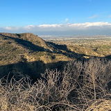
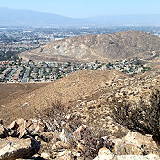
Mount Jurupa is the highest point of the Jurupa Mountains. A hiking trail leads to its summit, which offers panoramic views of Riverside, Fontana, San Bernardino, and Moreno Valley.
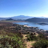
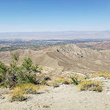
The Coachella Valley Vista Point is a scenic viewpoint located along a high point of the Santa Rosa and San Jacinto Mountains, offering spectacular vistas of the Coachella Valley. This location is often reached via Highway 74, known as the Palms to Pines Scenic Byway. It provides visitors with breathtaking panoramic views of the Coachella Valley and the surrounding desert landscapes.
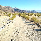
Cove Oasis Trailhead is a 114 acre natural open space area that is located at the southernmost part of the Cove. Access to the Cove Oasis area is located on Calle Tecate. Trails such as the Boo Hoff and Bear Creek can be accessed from the trailhead.
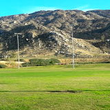
Lake Cahuilla Veterans Regional Park is a beautiful 710-acre park set amid expansive lawns and picturesque mountain views, making it a spectacular day or overnight destination.
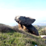
Pumpkin Rock is located in Norco, California is a registered hiking trail across Social media come on up and enjoy this Famous pumpkin which stands at 15' tall with great views. Kid friendly plus Dogs and Horses.