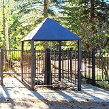
Von Schmidt Monument Historic Park is a small park located northwest of Verdi, near the Nevada/California border. You stand at a crossroads of human history, dating back to the time of mammoth hunters. This route across the Sierra Nevada was a vital path for Native Americans, mountain hunters, horse-drawn cart pioneers, miners, caravans, and travelers along the Lincoln Highway.
Pike is a census-designated place in Sierra County, California. It sits at an elevation of 1,050 m. Pike is 8.5 miles (13.7 km) west-southwest of Alleghany. The community was named after Pike County, Missouri. The population was 159 at the 2020 census.
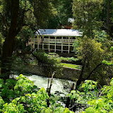
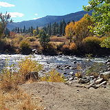
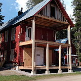
Sierra Shangri-La is a small mountain resort featuring cabins and lodging rooms dramatically perched right on the bank of the North Yuba River. It is located in the heart of the northern Sierra Nevada, surrounded by scenic beauty, gold rush history, and unlimited outdoor recreation.
Goodyears Bar is a census-designated place in Sierra County, California. Goodyears Bar is located along the North Yuba River and California State Route 49 3.25 miles (5.23 km) west-southwest of Downieville. Its population was 69 in 2020.
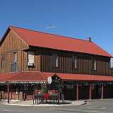
Loyalton is the only incorporated city in Sierra County, California. At the 2020 census, the population was 740. Many of the population are ranchers, loggers, former loggers, or suburbanites who have relocated from the San Francisco Bay Area, Sacramento, and growing Reno–Tahoe area.
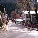
Downieville is a census-designated place in and the county seat of Sierra County, California. Downieville is on the North Fork of the Yuba River, at an elevation of 2,966 feet (904 m). Downieville's population was 290 in 2020. The village built along the banks of two pristine spring and snowmelt-fed rivers is a year-round destination.
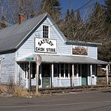
Sattley, formerly known as Church's Corners, is a census-designated place in Sierra County, California, United States. Sattley is located on California State Route 49 and California State Route 89 southwest of Loyalton. Sattley had a population of 44 in 2020.
Calpine is a census-designated place in Sierra County, California, United States. Calpine sits at an elevation of 5,689 feet (1,734 m). The 2020 United States census reported Calpine's population was 223.
Yuba Pass is a mountain pass on State Route 49 in Sierra County in the U.S. state of California. The pass lies at an elevation of 6,710 ft (2,050 m) about 3.4 air miles west of Sattley, on the divide between the North Yuba River and the Middle Fork Feather River (Sierra Valley).
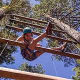
Located along the peaceful headwaters of the North Yuba River in the splendid Tahoe National Forest, Shaffer's High Sierra Camp is a springboard for boys and girls aged 8 to 17 to meet new friends from around the world, try activities that are new to them, and grow their social skills, self-confidence, independence, and appreciation of nature.
Sierra Brooks is a census-designated place in Sierra County, California. Sierra Brooks sits at an elevation of 5,180 feet (1,580 m). The 2020 United States census reported Sierra Brooks's population was 467.
Sierraville is a census-designated place in Sierra County, California. It is at the southern end of the huge Sierra Valley which is used primarily as pasture and is also at the junction of California State Route 49 and California State Route 89 southwest of Loyalton. The population was 239 as of the 2020 census.
Verdi is a census-designated place in Sierra County, California. Verdi sits at an elevation of 5,315 feet (1,620 m). The 2020 United States census reported Verdi's population was 179. It is just across the state line from Verdi, Nevada and below the Verdi Range.
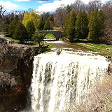
Webber Falls plunges 76 feet into a deep gorge carved out of basaltic bedrock. It is located in Sierra County. The water for Webber Falls comes out of Webber Lake which is privately operated and not open to public access. The falls themselves drop in several cascades with the largest cascade at the bottom level falling about 50 feet.
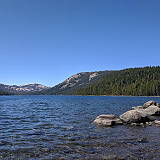
Webber Lake offers a great camping experience between Truckee and Sierraville. Webber Lake Campground's 46 sites are open when conditions permit in the spring until October 15, or when winter weather shuts it down. All sites are spacious, well shaded and come with a table, fire pit and bear box.
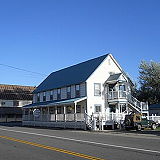
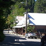
Alleghany is a small census-designated place in Sierra County, California in the Sierra Nevada. It is situated in the Gold Country and continues to be a significant locale for gold mining. The town is home to a post office, a bar, and a mining museum. The population was 30 at the 2010 census.
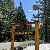
Sierra County is a county located in the U.S. state of California. As of the 2020 census, the population was 3,236, making it California's second-least populous county. The county seat is Downieville; the sole incorporated city is Loyalton. The county is in the Sierra Nevada, northeast of Sacramento on the border with Nevada.
Sierra City is a small, picturesque mountain town located in the northern Sierra Nevada mountain range in Sierra County, Northern California. It's part of the Gold Country region and is nestled in a scenic area surrounded by forested mountains. Sierra City is a small town with a population of 221 at the 2010 census, making it a peaceful and close-knit community.
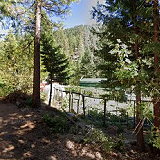
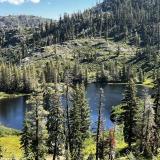
Independence Lake is one of the most pristine alpine lakes west of the Rockies. The lake and surrounding alpine forests offer exceptional recreation, including hiking, fishing, kayaking and bird watching in the beautiful Sierra Nevada.