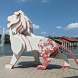
The Singapore Discovery Centre is an educational and tourist attraction managed by the Singapore Ministry of Defence, located in Jurong West, Singapore. The centre features exhibits showcasing Singapore's history as well as a vision of the future. It also offers a variety of engaging activities, from relaxing family games to team-building activities.
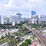
Jurong is a strategically important area located at the southwesternmost point of Singapore's Western Region. The area is notable for its expansive Jurong Lake Gardens, lakeside promenades, and green spaces. Jurong also includes several offshore islands, among them Pulau Damar Laut and Pulau Samulun.
Bedok is a planned residential area and town located within the Tanah Merah Geographic Area along the southeastern coast of East Singapore. It is known for its vibrant culinary scene, rich history as an old fishing village, and popular outdoor recreational areas. Bedok is the second most populous planned area in the country, with 274,360 residents in 2025.
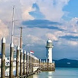
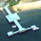
Bedok Pier is a popular fishing pier located in Bedok, Singapore. The 300-meter-long pier is renowned for its stunning ocean views and is a favorite destination for fishing, relaxing, and enjoying outdoor activities. The pier offers a tranquil environment where visitors can unwind while admiring the Singapore Strait.
The Singapore City Gallery is a prominent urban planning exhibition center located within the Urban Development Authority building in Singapore. It comprehensively showcases Singapore's achievements in urban development, planning, and architecture. The gallery presents detailed models, maps, and artifacts illustrating the city's development process, future plans, and sustainable development initiatives.
Ubud is a town in Gianyar district, Bali, Indonesia. It has been an important center of Balinese culture and local spirituality, attracting artists and tourists for nearly a century. Ubud remains one of the best places to visit temples, admire Balinese art, watch dances and cultural performances, as well as practice yoga and pursue a healthy lifestyle.
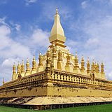
Vientiane Prefecture is a prefecture of Laos, located in northwestern Laos, near the border with Thailand. The capital city, Vientiane, is within the prefecture. The prefecture was established in 1989, when it separated from Vientiane Province. The estimated population of the prefecture in 2015 was approximately 820,000 people.
Hương So is an area in Hue city, Vietnam. It is located in the northeast of Hue city, about 5 km from the city center. The population in 2022 was 18,225 people.
Di tích Lịch sử Thành cổ Quảng Trị, also known as Quang Tri Ancient Citadel, is an ancient fortress located in Quang Tri Province, Central Vietnam. Built in 1824 during the Nguyen Dynasty, this fortress once served as a military stronghold to protect Vietnam's border against invading forces.
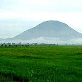
Núi Bà Đen, also known as Black Virgin Mountain, is a historical and beautiful mountain located in Tay Ninh province, Viet Nam covering an area of more than 24 km2.
Lang Son is a province in northern Vietnam. Its capital is also called Lang Son, which is astrategically important town at the border with Chinaand is 137 kilometres northeast of Hanoi connected by rail and road.
Lao Cai is a province of the mountainous Northwest region of Vietnam bordering the province of Yunnan in China. The province covers an area of 6,383.9 square kilometres and as of 2008 it had a population of 602,300 people. Lao Cai is also the capital of Lao Cai province and shares border with the city of Hekou, in the Yunnan province of Southwest China.
Gia Lai is a province located in the Central Highlands region of Vietnam. It is situated in the central part of Vietnam, bordering Cambodiato the west. The province is known for its mountainous terrain, lush forests, and beautiful landscapes. As of 2003 the province had a population of 1,641,829.
Kien Giang is a former province of Vietnam, located in the Mekong Deltaregion of southern Vietnam. It is known for fishing and rice farming. The provincial capital is Rach Gia, 155 mi (249 km) from Ho Chi Minh City. Kien Giang's areais about 6,299 km2 (2,432 sq mi) and its population is about 1,634,043, of which 22 percent live in urban areas.
An Giang is a province of Vietnam. It is located in the Mekong Delta, in the southwestern part of the country. It had a population of 1,909,507 in 2021.
Da Lat is a region in Lam Dong province, in the Central Highlands of Vietnam. It is located at an altitude of 1,500 m (4,900 ft) above sea level on the Lang Bien plateau. Da Lat is one of the most popular tourist destinations in Vietnam. The population of Da Lat was 231,225 in 2020.
Dak Lak is a province of Vietnam. It is located in Vietnam's Central Highlands, and is home to quite afew indigenous ethnic minorities, such as the Rade, the Jarai and the Mnong, among others. It had a population of 2,269,322 in 2021.
Thai Nguyen is a province in the Northeast region of Vietnam. It is a mountainous, midland province with a natural land area of 3,526.64 square kilometres (1,361.64 sq mi) and a population of 1,286,751 as of 2019. Its multi-ethnic society is composed of eight ethnic groups.
Quang Ngai is a province in the South Central Coast region of Vietnam, on the coast of East Sea. It had a population of 1,631,697 in 2021. It is located 883 kilometres (549 mi) south of Hanoi and 838 kilometres (521 mi) north of Ho Cha Minh City. The province has been historically populated with H're people and ethnic Kinh, and located on the coast.
Quang Tri is a province in the central region of Vietnam. Its main city is Dong Ha. It is known for its scenic landscapes, historic landmarks, and vibrant culture. Some popular attractions in Quang Tri include the ancient citadel of Quang Tri, the Ben Hai River, and the Vinh Moc Tunnels. It had a population of 701,375 in 2021. Additionally, Quang Tri is home to delicious Vietnamese cuisine, friendly locals, and plenty of outdoor activities such as hiking, swimming, boating, and more.
Tuyen Quang is a province of Vietnam, located in the northeastern part of the country to the northwest of Hanoi, at the centre of Lo River valley, atributary of the Red River. Its capital is Tuyen Quang. The province had a population of 784,811 in 2019, with a density of 130 persons per km2 over a total land area of 5,867.3 square kilometres (2,265.4 sq mi).
Long Thành is a ward in Dong Nai province, southern Vietnam, located 70 km northwest of Vung Tau and 20 km southwest of Bien Hoa. Its population was 246,051 in 2019.
Nghe An is a province in the North Central Coast region of Vietnam. It is Vietnam's largest province by area. Nghe An is located in acentral position in North Central Coast. To the east lies the Gulf of Tonkin; to the west the province is bordered by Laos; to the south Ha Tinh province; and to the north is Thanh Ha³a province. It had a population of 3,727,791 In 2021.
Thanh Hóa is a province in the North Central Coast region of Vietnam. This is a relatively large province, which ranks as fifth in area and as third in population among 63 central administrative subdivisions. Its capital and largest city is Thanh Hoa City. The province is widely called Xu Thanh (The Land of Thanh). It had an area of 11,133.4 km2 and a population of approximate 3.6 million.
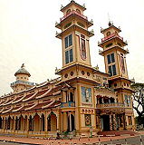
Tay Ninh is a province in the Southeast region of Vietnam, with the capital at the town of Tay Ninh. The province has a population of 1,169,165 (in 2019) and an area of 4,041.4 km2.
Ca Mau is a province of Vietnam, named after its provincial capital city. Located in the Mekong Delta in southern Vietnam, it is the southernmost of Vietnam's 63 provinces. Ca Mau borders Kien Giang and Bac Lieu provinces to the north, the Gulf of Thailand to the west, and the South China Sea to the south and east. The province's population was 1,521,894 in 2021.
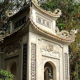
Đền Hùng, also known as Hung Kings Temple Complex, is a historic and cultural site located in Viet Tri, Phu Tho Province, Vietnam. It is one of the most important and revered religious sites in Vietnam, holding profound historical and cultural significance.
Phu Tho is a province of Vietnam with a rich cultural heritage and many historical sites to explore. Located in the northwest of the country, it is home to Hung Temple, the ancestral worship site of ancient Vietnamese kings. Phu Tho province is projected to have a population of 4,022,638 in 2025.
Ha Tinh is a province on the North Central Coast of Vietnam. Together with neighbouring Nghe An province the two provinces are together called "Nghe Tinh", and the locals are known for speaking Vietnamese with a very noticeable regional accent. It had a population of 1,501,866 in 2021.
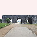
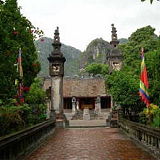
Cố Đô Hoa Lư (Hoa Lu Ancient Capital) is a district and the legendary ancient capital of Viet Nam located in the Ninh Binh province. It is known for its historical and cultural significance as the ancient capital of Vietnam during the Dinh and early Le dynasties. Hoa Lu served as the political and economic center of the country from the 10th to the 11th century.
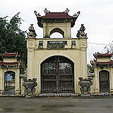
Phố cổ Hoa Lư, , located in Tan Thanh Commune, Ninh Binh Province, Vietnam, is a famous historical ancient town with rich cultural heritage and historical significance. It was the capital of Vietnam under the Dinh and Le dynasties in the 10th and 11th centuries, becoming an important political and cultural center of the country.
Tuyệt tình Cốc, also known as Dong Am Tien or Am Tien Cave, is a scenic spot located in Truong Yen commune, Hoa Lu District, Ninh Binh province, Vietnam. It is part of the larger Trang An Scenic Landscape Complex, a UNESCO World Heritage Site known for its natural and cultural significance.
Quang Ninh is a province along the northeastern coast of Vietnam. It is about 153 km (95 mi) east of Hanoi, comprising four cities, two district-level towns and seven rural districts. The provincial capital is Ha Long. The province covers an area of 6178.21 square kilometres and, as of 2019, had a population of 1,320,324.
Ninh Binh is a province in the Red River Deltaregion of northern Vietnam. Known for its stunning scenery of limestone karsts, rice paddies, and rivers. Ninh Binh is often referred to as the "Halong Bay on land." The population is 898,500 people, with a total area of 1,329.4 km2.
Bac Ninh is a province of Vietnam, located in the Red River Delta of the northern part of the country. It is the smallest province of Vietnam by area and is situated to the east of the nation's capital, Hanoi, and borders Bac Giang province, Hung Yen province, Hai Duong province and Hanoi. The province covers an area of 822.71 square kilometres and as of 2022 it had a population of 1.488.250.
Dong Nai is a province located in the southeastern region of Vietnam. It is situated approximately 30 kilometers (19 miles) northeast of Ho Chi Minh City, making it part of the broader metropolitan area of Saigon. Dong Nai Province is known for its economic significance, industrial development, and natural beauty.
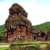
Thánh địa Mỹ Sơn is an ancient archaeological site located in Quang Nam Province, Vietnam. It is known for its remarkable ruins of Hindu temples and structures from the Champa civilization. It possesses 71 monuments and 32 epitaphs, the content of which is still being studied.
The Western Islands are a planned area located within the Western Region of Singapore. This area comprises a group of islands situated in the waters southwest of Singapore, specifically Jurong Island, Bukom Island, Semakau Island, and Sudong Island.
The North East Islands are a planned area and group of islands located within the North East Region of Singapore. This group comprises three islands: Pulau Tekong, Pulau Tekong Kechil, and Pulau Ubin. These islands are primarily used for military training (Pulau Tekong) and feature rustic historical sites with a focus on nature (Pulau Ubin).
The Southern Islands are a planned area comprising a group of small islands located within Singapore's Central Region. The islands making up this planned area are Kusu Island, Lazarus Island, Seringat Island, Tekukor Island, Saint John Island, Sentosa Island, and the two Sister Islands. The population was 2,680 in 2025.
Hon Khoai is an island located in Ngoc Hien district, the Ca Mau Province of Vietnam, about 15km away from the mainland. This is a group of five islands of Hon Khoai, Hon Sao, Hon Doi Moi, Hon Da Le and Hon Tuong. Among these islands, Hon Khoai is the biggest one.
Điểm cực Nam Tổ Quốc, also known as the Dat Mui National Landmark, is a significant landmark located in Dat Mui, a coastal area within Ngoc Hien commune, Ca Mau Province. Ca Mau is located in the southernmost part of Vietnam. Its geographic importance, cultural significance, and scenic beauty make it a destination of interest for travelers exploring the southern regions of Vietnam.
Nam Giao Esplanade (Đàn Nam Giao) - The three-terraced heaven and earth esplanade - was constructed in 1806 where the Nguyen emperors held heaven and earth ceremonies in the spring every three years for the welfare of the country and the stability of the dynasty.
Phá Tam Giang, also known as Tam Giang Lagoon, is a large lagoon located in Hue City, Vietnam. It is the largest lagoon in Southeast Asia, spanning an area of approximately 22,000 hectares. The lagoon was formed by the confluence of three rivers: O Luc, Huong, and Bo. Tam Giang Lagoon is renowned for its spectacular natural scenery, with tranquil waters, lush mangrove forests, and picturesque fishing villages.
Bưu điện thị xã Bà Rịa, 27 Tháng 4, Tân Hải, Hồ Chí Minh, Vietnam
238 views 💖 1
About 6 km from Ba Ria, Núi Dinh or Dinh Mountain has long been a favorite destination of adventure travel enthusiasts, especially young people. It includes more than 100 temples located around the mountain. Tien stream and Da stream originate from Dinh Mountain and flow down with a height of nearly 500m from the top.