
|
Lake Victoria Africa Last Updated: 01/01/2025 |
| Lake Victoria is the largest lake in Africa and the second-largest freshwater lake in the world by surface area, covering approximately 68,800 square kilometers (26,600 square miles). It is shared by three countries: Tanzania, Uganda, and Kenya. | |
| - Lake Victoria is situated in the East African Rift region. The lake has a relatively shallow average depth of 40 meters (130 feet) and a maximum depth of about 80 meters (262 feet). It lies at an elevation of about 1,135 meters (3,724 feet) above sea level. - Its main inflows are rivers like the Kagera River and numerous smaller streams. The primary outflow is the Victoria Nile, which eventually feeds into the Nile River system. - Lake Victoria is home to a rich diversity of fish, particularly cichlids, many of which are endemic. However, the introduction of the Nile perch in the mid-20th century has caused significant ecological changes, leading to the extinction of many native fish species. The lake also supports diverse bird species and aquatic plants. - The lake supports millions of people through activities like fishing, agriculture, and transportation. It is a key source of freshwater and hydroelectric power for the region. | |
Website Wikipedia Facebook
World » Wrd
Place » Lake
|
Lake Huron Place » Lake With the longest shoreline of all of the Great Lakes, Lake Huron is one of the most unique lakes on Earth. It is the second largest of the Great Lakes, and the fourth largest lake in the world by surface area. Huron is renowned for its beaches, sand dunes, wetlands, forests, and extensive river systems. 259 views 💖 1 👍 0Lake Huron |
|
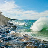
Lake Superior Place » Lake Lake Superior is the largest freshwater lake in the world by surface area. It is the world's third-largest freshwater lake by volume and contains nearly 10% of the word’s fresh surface water. Lake Superior is relatively young, approximately 10,000 years old dating back to the last glacial retreat. The Lake Superior watershed includes the surrounding areas of Ontario, Minnesota, Wisconsin and Michigan. 214 views 💖 1 👍 0Lake Superior |
|
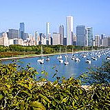
Great Lakes Place » Lake The Great Lakes are a group of five large freshwater lakes located in North America on the border between the United States and Canada. They are the largest group of freshwater lakes by total area in the world and hold about 21% of the world's surface fresh water. 232 views 💖 2 👍 0Great Lakes |
|
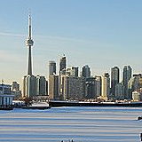
Lake Ontario Place » Lake Lake Ontario is one of the five Great Lakes of North America and the easternmost of the group. Lake Ontario is bordered by the province of Ontario in Canada to the north, west, and southwest, and the state of New York in the United States to the south and east. It is the smallest of the Great Lakes by surface area but has significant depth. 207 views 💖 1 👍 0Lake Ontario |

|
Lake Tanganyika Place » Lake Lake Tanganyika is one of the most remarkable natural features of East Africa and the world. The lake spans four countries: Burundi, Democratic Republic of the Congo (DRC), Tanzania, and Zambia. It is part of the East African Rift system. The lake is estimated to be 9–12 million years old, making it one of the oldest lakes in the world. 128 views 💖 1 👍 0Africa |

|
Lake Malawi Place » Lake Lake Malawi, also known as Lake Nyasa in Tanzania and Lago Niassa in Mozambique, is an African Great Lake and the southernmost lake in the East African Rift system, located between Malawi, Mozambique and Tanzania. This vast body of crystal clear freshwater fringed by beaches of golden sand is not only a scenic wonderland but it provides water sport opportunities for those looking for something beyond sun, sand and swimming. 140 views 💖 1 👍 0Africa |

|
Universe Place » City The universe is all of space and time and their contents. It comprises all of existence, any fundamental interaction, physical process and physical constant, and therefore all forms of matter and energy, and the structures they form, from sub-atomic particles to entire galactic filaments. 228 views 💖 1 👍 0Universe |

|
Lake Erie Place » Lake Lake Erie is the fourth-largest of the five Great Lakes of North America by surface area and the smallest by volume. It borders four U.S. states—Ohio, Pennsylvania, New York, and Michigan—and the Canadian province of Ontario. 268 views 💖 1 👍 0U.S. |
|
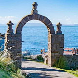
Lake Titicaca Place » Lake Lake Titicaca is one of the most iconic and fascinating natural landmarks in South America. Straddling the border between Peru and Bolivia, it is known for its stunning beauty, rich cultural history, and unique ecological significance. There are numerous ancient ruins around the lake, such as the Chullpas (funerary towers) and Tiwanaku sites near its shores. 173 views 💖 1 👍 0South America |

|
Lake Mweru Place » Lake Lake Mweru is a freshwater lake located on the border between Zambia and the Democratic Republic of Congo (DRC) in central Africa. It is part of the Congo River basin and lies along the course of the Luapula River, which flows into the lake from the south and exits into the Luvua River in the north. 135 views 💖 1 👍 0Africa |
