|
Lake Tahoe California ☎ +1 800-288-2463 Last Updated: 05/24/2024 |
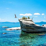
| Lake Tahoe is located on the border of California and Nevada. About two-thirds of the lake is in California, with about one-third extending into Nevada at the north and south ends of the lake, and the entire eastern shore. Since part of South Lake Tahoe extends into Nevada, gaming is legal in South Lake Tahoe. | |
| Lake Tahoe is the third deepest lake in North America and the 10th deepest in the world. Tahoe’s deepest point is 1,645 feet near Crystal Bay. The average depth of Lake Tahoe is 989 feet. All parts of Lake Tahoe are beautiful and have something unique to offer. South Lake Tahoe is popular for its ski resorts like Heavenly, Sierra at Tahoe and Kirkwood ski resorts. South Lake Tahoe is also popular for its restaurants, shopping, casino resorts and vibrant nightlife. | |

Website Wikipedia Facebook
California » Ca
Place » Outdoors
|
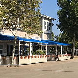
Grizzly Bay Place » Outdoors Grizzly Bay is a small bay within San Francisco Bay, and an extension of Suisun Bay, located deep within Solano County. Grizzly Bay contains numerous inlets, wildlife preserves, and islands such as Grizzly Island, Joice Island, and Morrow Island. It is also the base of the 5th Reserve Fleet, anchored off Benicia. Suisun Creek and Cordelia Creek flow into Grizzly Bay. 6 views 💖 1California |
|
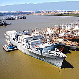
Suisun Bay Place » Outdoors Suisun Bay is a shallow tidal estuary in Northern California. It lies at the confluence of the Sacramento and San Joaquin Rivers, forming the entrance to the Sacramento-San Joaquin Delta, a reverse-flowing river delta. The bay was formerly the home base of the Suisun Bay Reserve Fleet, part of the United States Navy's Reserve Fleet or Ghost Fleet. 27 views 💖 1California |
|
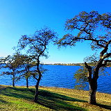
Camanche Reservoir Place » Outdoors Lake Camanche is a man-made lake located in the San Joaquin Valley of California, at the intersection of Amador, Calaveras, and San Joaquin counties. Lake Camanche is an award-winning campground, offering year-round recreation and fishing. With a shoreline of 54 miles and a surface area of 7,700 acres, it's ideal for all kinds of outdoor recreation. 136 views 💖 1California |
|
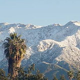
San Gabriel Mountains Place » Outdoors The San Gabriel Mountains are located in Los Angeles and San Bernardino counties, California. This vast mountainous region forms a natural boundary between Los Angeles and the Mojave Desert, crisscrossed by numerous winding roads and trails, and is home to a diverse array of wildlife, including black bears, mountain lions, coyotes, bighorn sheep, and black-tailed deer. 136 views 💖 1California |

|
Badwater Basin Place » Outdoors Badwater Basin is an endorheic basin in Death Valley National Park, Death Valley, Inyo County, California. It is the lowest point in North America at 282 ft (86 m) below sea level. The salt flats here cover nearly 200 square miles (518 square km), and are composed mostly of sodium chloride (table salt), along with calcite, gypsum, and borax. 452 views 💖 1California |

|
Mount Lassen Place » Outdoors Mount Lassen, located in northern California, is a prominent volcanic peak in the Cascade Range. Officially known as Lassen Peak, it is the southernmost active volcano in the Cascades and part of Lassen Volcanic National Park. Lassen Peak stands at 10,457 feet (3,187 meters). 436 views 💖 1California |

|
Ubehebe Crater Place » Outdoors Ubehebe Crater is a prominent volcanic feature located in the northern section of Death Valley National Park, California. It is part of the Ubehebe Craters volcanic field, which includes several overlapping craters formed by explosive volcanic activity. The largest crater is about 800 m (0.5 mi) wide and 250 m (800 ft) deep. 575 views 💖 1Furnace Creek, California |

|
Smith River Place » Outdoors Winding through California’s northwest corner, the Smith River is the crown jewel of the Wild and Scenic River system. Rising in three major forks from the Klamath Mountains and Coast Range, the Smith runs wild and free through towering redwood and Douglas fir forests to the Pacific Ocean—all without a single dam. 630 views 💖 1California |

|
Salton Sea Place » Outdoors The Salton Sea is a shallow, landlocked, highly saline endorheic lake in Riverside and Imperial counties at the southern end of the U.S. state of California. It lies on the San Andreas Fault within the Salton Trough, which stretches to the Gulf of California in Mexico. The lake is about 15 by 35 miles (24 by 56 km) at its widest and longest. A 2023 report put the surface area at 318 square miles (823.6 km2). 442 views 💖 1California |

|
Mojave Desert Place » Outdoors The Mojave Desert is a desert in the rain shadow of the southern Sierra Nevada mountains and Transverse Ranges in the Southwestern United States. It occupies a significant portion of Southern California and parts of Utah, Nevada, and Arizona. Named after the Mojave Native Americans it occupies roughly 54,000 square miles in a typical Basin and Range topography. 423 views 💖 1California |